
MAKS Building Documents
Building Document Management with MAKS–NVI Integration
The MAKS Building Documents Management System receives building permits, occupancy permits and burned or demolished building records issued by municipalities as change records over the MAKS–NVI integration, stores them in the institution's database and makes them available through GIS-based querying, reporting and analysis tools.
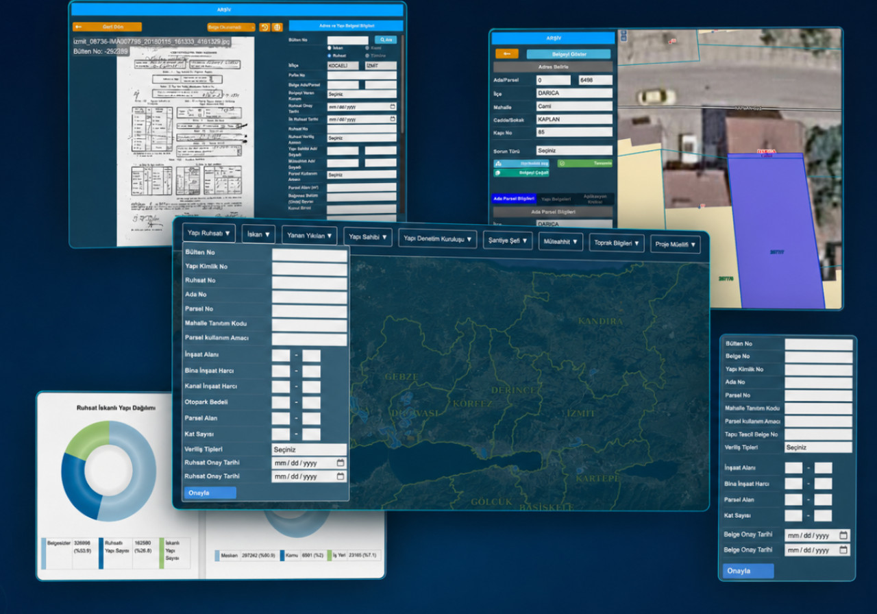
Manage building documents from one place — current data, digital archive and the map
The system brings current MAKS–NVI records, digitised legacy archive documents and GIS analysis tools together on a single institutional platform.
MAKS–NVI Change Integration
New and updated building documents are pulled from MAKS services as change records and flow into the institutional database on a regular schedule.
Central Document Management
Building permits, occupancy permits and burned/demolished building forms are managed in a single system.
Advanced Document Search
Query documents by bulletin number, building ID, parcel, neighbourhood, date and many more criteria.
GIS-Based Visualisation
Building documents are displayed and analysed on the map together with parcel, building and address data.
MAKS–NVI Change Integration
New and updated building documents are received from MAKS services as change records and transferred to the institutional database on a regular basis. Every record is validated, matched with existing address and building data, and stored traceably.
Central management of building documents
The core building documents issued by the municipality are managed in one system on a shared data model.
Building Permit
Building permits issued by municipalities, kept current through change records.
Occupancy Permit
Occupancy permits managed in relation to building and unit records.
Burned & Demolished Buildings
Burned/demolished building forms archived for periodic analysis.
Advanced document search
Documents are located quickly through identifiers as well as the parties involved in the process.
Digitising the legacy archive
Legacy municipal archive documents that don't exist in MAKS or NVI can be scanned and imported. Information on each document is indexed manually and linked to current address, parcel and building records — making decades of institutional document memory searchable alongside current data.
- 1Scanned document image is added to the system
- 2Document details are indexed and stored
- 3Matched to current address, parcel and building records
Analyse construction on the map
Permit, occupancy and archive information is linked to parcel and building geometry and presented on the map. Users build thematic maps on the criteria they choose, and explore construction density, document status and regional distribution visually.
- Permitted, occupied and undocumented buildings
- Building distribution by document type
- Building use categories
- Document issue years
- Floor and unit counts
- Construction density by neighbourhood
Turn construction data into decision support
The system does more than store the municipal document archive — it turns the change in construction over the years into measurable, comparable indicators.
Scattered building documents become unified institutional data
- Current, traceable data flow through MAKS–NVI
- Legacy archive unified with current records in one system
- Reduced dependence on the physical archive
- Fast access to any document, address, parcel or building
- Detection of duplicate and unmatched records
- Shared data use across municipal departments
- Map-supported reporting and decision support
- Preservation of institutional data memory
Request a meeting
Let's explore how the MAKS Building Documents Management System can add value to your building document processes.
Request a MeetingOther Solutions
NOYAS
GIS-Based Integrated Fire Department Information System
Manage every fire-department process — from incident response and reporting to fleet, training, inspection and digital applications — on a single GIS-based platform.
NOLEVS
Noktasal Sign Management System
A GIS-supported sign management platform that handles street and door-number signs end-to-end: requests, production, stock, field installation, maintenance and reporting.
NOTES
Noktasal Real Estate Inventory System
A modular real estate management solution that lets you manage your institution's property inventory geographically.