NOYAS
GIS-Based Integrated Fire Department Information System
NOYAS is a GIS-based integrated information system that runs the operational and administrative processes of municipal fire departments end-to-end. Incident reports, duty rosters, activity logs, fleet & inventory, maintenance, training & certification, digital fire-permit applications, industrial-facility inspections, chimney cleaning, hydrants and rural tankers are all managed from one center. With GIS and MAKS integration, incident coordinates and addresses are verified, and response, inspection, water source, facility and crew data become visible on the map.

One command center for the entire fire department
NOYAS is not just an incident log. It unifies pre-incident readiness, real-time operations, post-incident reporting, field inspections, fleet & inventory checks, training and internal coordination on one platform.
GIS & MAKS Based Incident Management
Incident coordinates and addresses are verified via MAKS; risk layers visible on the map.
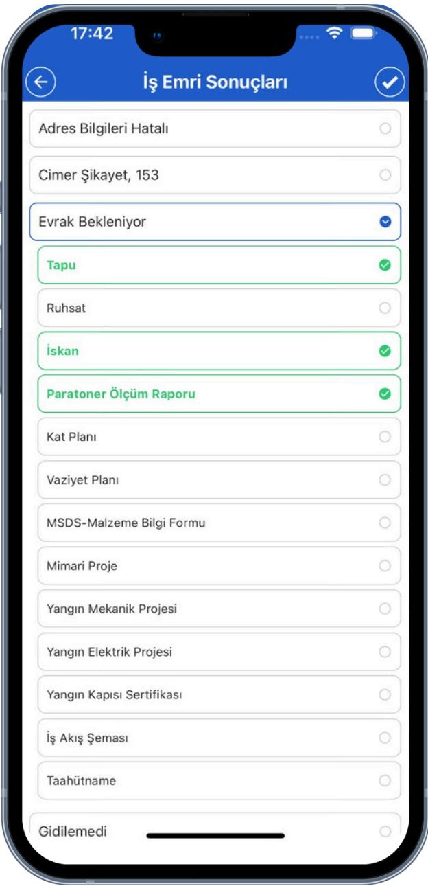
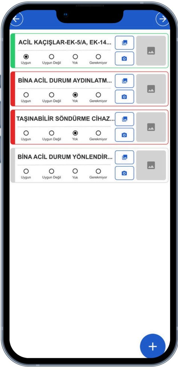
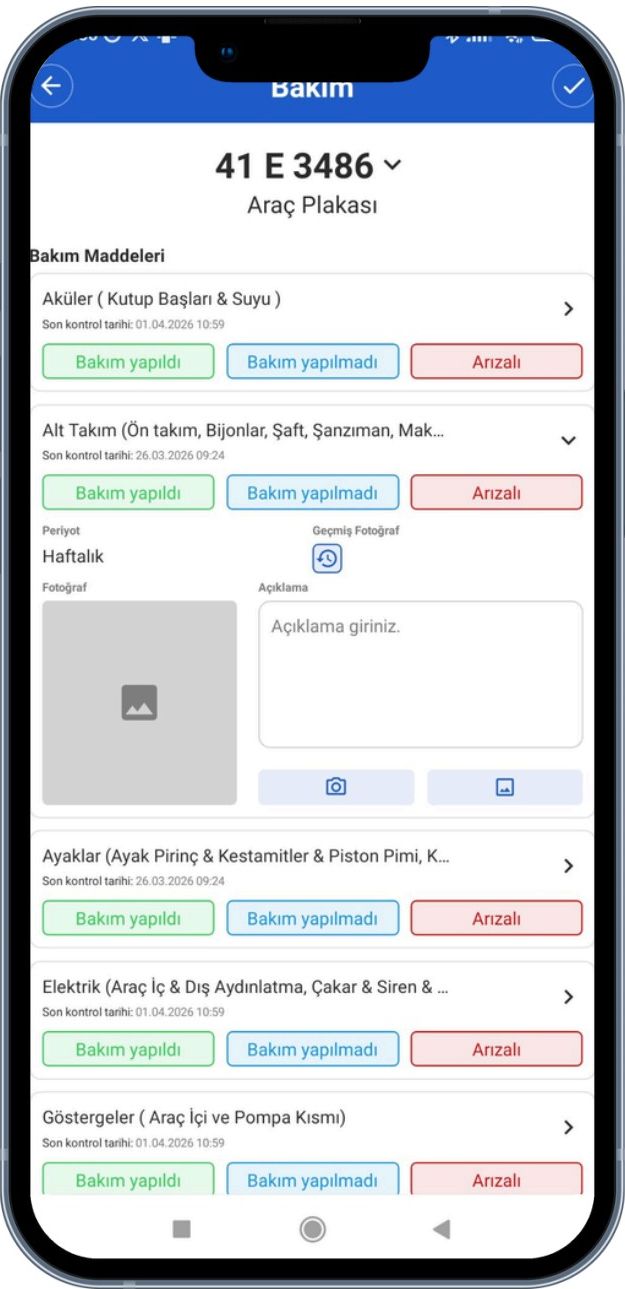
Mobile Field Operations
Field crews handle work orders, inspections and vehicle checks on phone or tablet.
Strategic Decision Support
Executive dashboards put incident, resource and performance data on one screen.
Regulation-Compliant Digital Workflow
Full alignment with the Municipal Fire Regulation, EBYS and Law No. 5070 on e-signatures.
The NOYAS module suite
NOYAS is modular — roll out one module at a time. Each delivers value on its own and together they form a department-wide digital transformation backbone.
Incident & Operations
From intake to post-incident reporting.
Incident & Operations
From intake to post-incident reporting.
Real-time situational awareness on the map
With its GIS foundation, NOYAS lets you manage incidents, hydrants, rural tankers, industrial facilities, crews and inspection zones on the map — enabling fast decisions, the right dispatch and proactive risk analysis.
A paperless, real-time workflow for field crews
With NOYAS mobile, crews receive tasks on tablet or phone. Inspection forms, vehicle and inventory checks, photos and locations stream to HQ in real time.
Integrations aligned with public institutions
NOYAS ships with ready integrations for compliant public-sector workflows.
Verifies incident coordinates and addresses with the national address system.
Document workflow integrated with the corporate EBYS system.
Approval with qualified e-signature under Law No. 5070.
Training documents and applications accessible via e-Government.
What NOYAS delivers to your department
Let's evaluate the product for your institution together — and plan which NOYAS modules to roll out, and in what order, based on your field organisation.
Request a meeting15-minute intro meeting
Operational Efficiency & Coordination
All units work on the same data, on the same map.
Mobile Field Ops & Real-time Data
Uninterrupted, photo-supported field-to-HQ flow.
Strategic Decision Support
Measurable performance via dashboards and reports.
Sustainable, Paperless Processes
End-to-end digital workflow with EBYS and e-signature.
Other Solutions
NOLEVS
Noktasal Sign Management System
A GIS-supported sign management platform that handles street and door-number signs end-to-end: requests, production, stock, field installation, maintenance and reporting.
NOTES
Noktasal Real Estate Inventory System
A modular real estate management solution that lets you manage your institution's property inventory geographically.
e-Kreş
Pre-school Education Management Software
An enterprise platform that manages student, parent, staff, payment and communication processes from a single hub for municipal nurseries, university preschools and private early-childhood education institutions.